

Temukan Hotel Bintang 3 di Alton mulai dari mulai dari Rp2.228.769
 Berubah pikiranPesan hotel dengan pembatalan gratis
 Banyak pilihanCari di hampir jutaan properti di seluruh dunia
Cek ketersediaan Hotel Bintang 3 di Alton
Malam ini
Besok
Akhir pekan ini
Akhir pekan berikutnya
Pilihan terbaik kami untuk hotel bintang 3 di Alton


9.2 dari 10, Istimewa, (526 ulasan)
"Vg"

Richard
Harga sekarang Rp1.956.485
total Rp2.228.769
termasuk pajak & biaya lainnya
3 Jul - 4 Jul


Harga sekarang Rp3.096.751
total Rp3.636.985
termasuk pajak & biaya lainnya
8 Jul - 9 Jul


9.6 dari 10, Sempurna, (86 ulasan)
"We spent two nights in this cabin. The location was great for us visiting Zion and Bryce Canyon National Parks. Only issue with the cabin was, the AC didn’t cool as good as I wanted and the vent wouldn’t stay set in place. The breakfast was good but doesn’t compare to the one at the name brand hotels and the cost was a lot more than the hotels. We had a good experience but, next time I would choose the hotel."
James
Harga sekarang Rp2.690.637
total Rp3.806.646
termasuk pajak & biaya lainnya
8 Jul - 9 Jul


7.8 dari 10, Bagus, (319 ulasan)
"Owner was having a baby so lobby and restaurant were closed. Check in info was in an envelope by the door. After a 10 hour drive and no nearby restaurants thank God I had a couple cans of soup to heat up in the microwave. Our room was called the "Ice Cave" fitting since it was so cold! Room was so small it was claustrophobic. Congrats on the baby, but have back up to run the hotel please."
Suzan


9.4 dari 10, Sempurna, (96 ulasan)
"Clean, quiet area, comfortable and cozy "
Andrea
Harga sekarang Rp3.164.793
total Rp6.296.190
termasuk pajak & biaya lainnya
6 Jul - 7 Jul

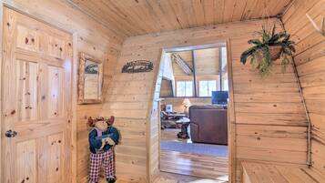

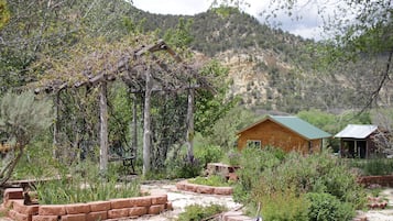
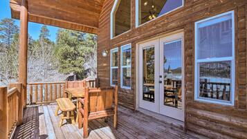
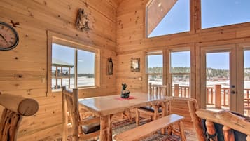
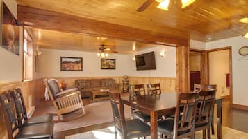
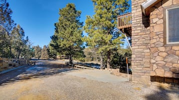
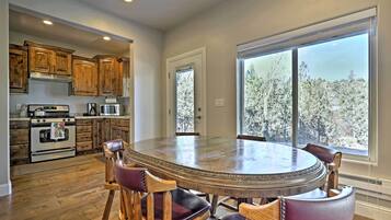
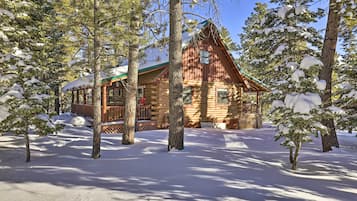
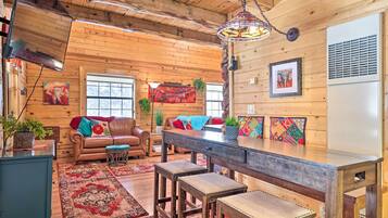
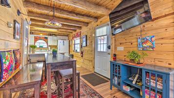
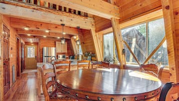
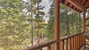
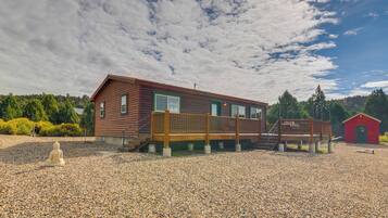
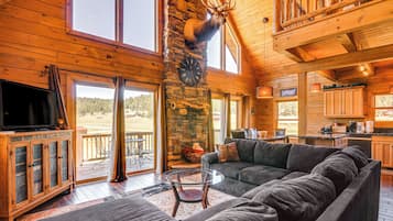
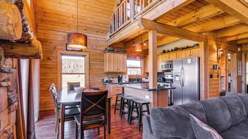
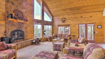
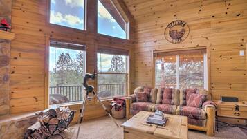
Spacious Duck Creek Village Cabin w/ Hot Tub!
Spacious Duck Creek Village Cabin w/ Hot Tub!Duck Creek Village


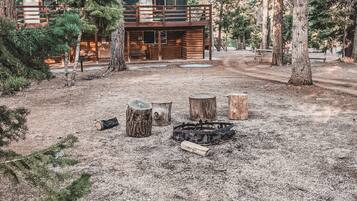
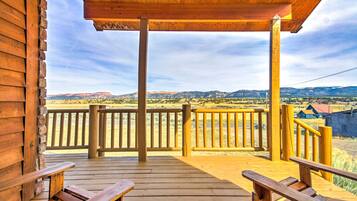
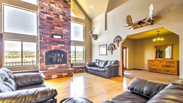
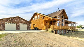
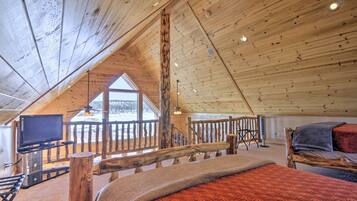
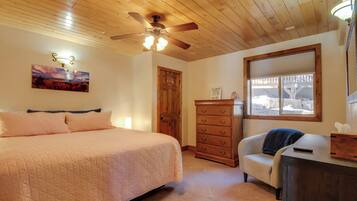
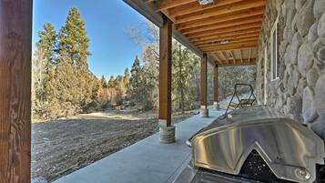
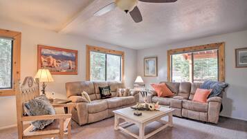
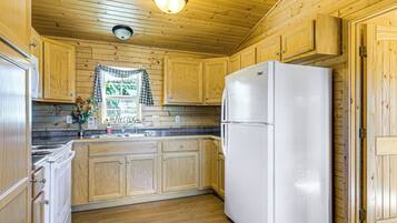
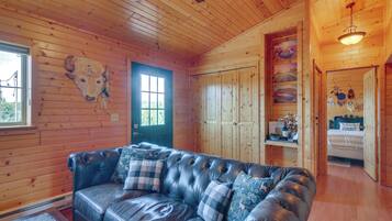
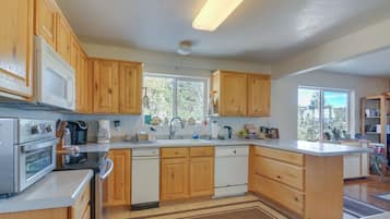
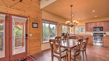
Newly Built, Modern Alton Cabin on 4 Acres!
Newly Built, Modern Alton Cabin on 4 Acres!Duck Creek Village
10.0 dari 10, Sempurna, (1 ulasan)
"Really nice cabin! Lots of entertainment for kids (e.g. Nintendo, pool, soccer table) Scenic view outside and great outdoor place to bbq! Certainly recommended for stay with kids and enjoy the National Parks in the area."

Roald


Hemat rata-rata 15% untuk ribuan hotel saat Anda login
Jelajahi hotel bintang 4 yang serupa
Banyak hotel bintang 4 memiliki fasilitas yang sama dengan hotel bintang 3. Lihat semua hotel bintang 4 di Alton.

The Lookout at Sevier River
152 East Carol's Lane Hatch UT
10/10 Sempurna! (12 ulasan)


Masih belum melihat apa yang Anda cari?
Lihat semua properti di Alton.
Anda juga dapat menggunakan filter populer untuk mempersempit pencarian Anda.
Harga per malam terendah yang ditemukan dalam 24 jam terakhir berdasarkan pencarian 1 malam untuk 2 tamu dewasa. Harga dan ketersediaan dapat berubah sewaktu-waktu. Ketentuan tambahan dapat berlaku.
Selengkapnya tentang Alton
Rasakan pendakian, margasatwa, dan petualangan di Alton!

Foto oleh Eric & Kristy's Adventures
Foto Terbuka oleh Eric & Kristy's Adventures
Ulasan Hotel Teratas di Alton
Ketahui lebih lanjut tentang Alton
Panduan Saku: Hotel Bintang 3 di Alton
Cari hotel di Alton, di Expedia.co.id. Anda dapat dengan mudah menemukan hotel di Alton menggunakan salah satu metode berikut:
- Lihat pilihan hotel unggulan kami di Alton
- Gunakan peta untuk menemukan hotel di lingkungan Alton yang Anda sukai
- Gunakan filter untuk melihat hotel pada area spesifik di Alton, pilih tema tertentu, merek, atau kelas hotel dari hotel dasar (Bintang 1) hingga hotel mewah (Bintang 5) di Alton
- Masukkan tanggal perjalanan Anda untuk melihat tawaran terbaik untuk hotel di Alton - selagi masih ada