

Hotel murah di Alton
 Berubah pikiranPesan hotel dengan pembatalan gratis
 Banyak pilihanCari di hampir jutaan properti di seluruh dunia
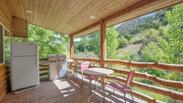
Lebih dari sekadar penginapan biasa di Alton
Cocok untuk keluarga
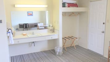
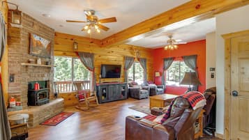
Apartemen
Periksa harga untuk tanggal ini
Malam ini
Besok
Akhir pekan ini
Akhir pekan berikutnya
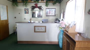
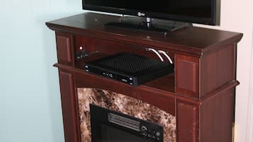
Pilihan terbaik kami untuk hotel dekat Alton


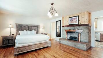
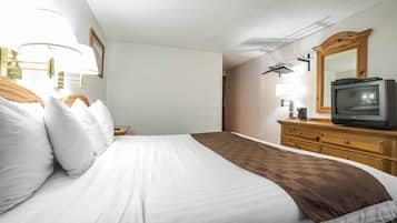
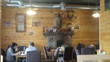
Bryce Canyon Pines
Bryce Canyon PinesBryce Canyon
8.0 dari 10, Sangat Baik, (1.001 ulasan)
"The place was mediocre. Breakfast was less than mediocre."

Yvonne
Harga sekarang Rp1.276.387
total Rp1.441.297
termasuk pajak & biaya lainnya
28 Jun - 29 Jun

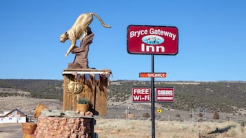

Bryce GatewayInn Cabins
Bryce GatewayInn CabinsPanguitch
7.8 dari 10, Bagus, (873 ulasan)
"The cabins were rustic but fun and worth the price charged"
kathleen
Harga sekarang Rp1.255.831
total Rp1.418.035
termasuk pajak & biaya lainnya
28 Jun - 29 Jun


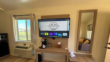
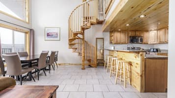
Mountain Ridge Cabins and Lodging
Mountain Ridge Cabins and LodgingHatch
9.2 dari 10, Istimewa, (1.000 ulasan)
"Loved the cabin! Great clean room and loved that even the linens smelled fresh which I find rare! If you’re in the area I highly recommended"
Nicholas
Harga sekarang Rp1.531.794
total Rp1.761.644
termasuk pajak & biaya lainnya
30 Jun - 1 Jul


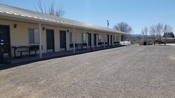
89 & Nine Motel
89 & Nine MotelOrderville
8.6 dari 10, Luar Biasa, (202 ulasan)
"Very nice convenient place. Pillows could be better and need a shelf or bench in the shower. Overall great place."
DAVID
Harga sekarang Rp1.710.955
total Rp1.966.230
termasuk pajak & biaya lainnya
30 Jun - 1 Jul


Rodeway Inn Bryce Canyon
Rodeway Inn Bryce CanyonPanguitch
8.0 dari 10, Sangat Baik, (1.002 ulasan)
"The location feels remote but you really are near things you could need, with more conveniences 10-min away. Everything from the room card, locks, blinds and switches, to water, light and ac unit, microwave and fridge, all work just fine. Stayed here for 3 nights and had zero issues. Friendly and professional staff."
Leilia
Harga sekarang Rp914.914
total Rp1.033.122
termasuk pajak & biaya lainnya
26 Jul - 27 Jul


Historic Smith Hotel B&B
Historic Smith Hotel B&BGlendale
9.2 dari 10, Istimewa, (526 ulasan)
"Vg"
Richard
Harga sekarang Rp1.967.450
total Rp2.241.260
termasuk pajak & biaya lainnya
29 Jun - 30 Jun

Hatch Station Motel and Restaurant
Hatch Station Motel and RestaurantHatch
8.4 dari 10, Sangat Baik, (437 ulasan)
"very good "
Kenny
Harga sekarang Rp915.093
total Rp1.052.716
termasuk pajak & biaya lainnya
30 Jun - 1 Jul


Best Western East Zion Thunderbird Lodge
Best Western East Zion Thunderbird LodgeOrderville
9.2 dari 10, Istimewa, (1.000 ulasan)
Harga sekarang Rp1.995.262
total Rp2.292.757
termasuk pajak & biaya lainnya
6 Jul - 7 Jul


The Lodge at Bryce Canyon
The Lodge at Bryce CanyonBryce Canyon
8.8 dari 10, Luar Biasa, (98 ulasan)
"- very nice stay
- unique location within the Bryce Canyon NP
- lovely staff at the front desk - always helpful and with a smile "

Nikolaj
Harga sekarang Rp3.279.083
total Rp3.702.741
termasuk pajak & biaya lainnya
21 Jul - 22 Jul

Bryce Zion Inn
Bryce Zion InnHatch
7.8 dari 10, Bagus, (553 ulasan)
"This is a great alternative for larger families like ours to having to rent multiple rooms. The quality and care of the interior of the rooms is evident right away. It offers an escape from the chaos of the Canyon alley hotels and is a quiet respite after a long day of hiking. We would definitely stay here again!"
Vincent
Harga sekarang Rp950.979
total Rp1.084.295
termasuk pajak & biaya lainnya
1 Jul - 2 Jul


The Riverside Ranch RV Park, Motel & Campground
The Riverside Ranch RV Park, Motel & CampgroundHatch
9.2 dari 10, Istimewa, (591 ulasan)
"Cute spot but beds were firm and noisy, if staying on main floor you can hear people walking above in other room. Very limited breakfast."

Brianna
Harga sekarang Rp1.658.774
total Rp1.873.087
termasuk pajak & biaya lainnya
29 Jun - 30 Jun


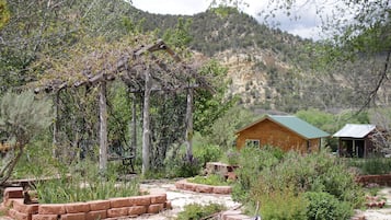
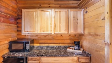
Arrowhead Country Cabins
Arrowhead Country CabinsMount Carmel
9.6 dari 10, Sempurna, (87 ulasan)
"We enjoyed our stay at Arrowhead Cabins. The owners are very sweet and helpful. The location was great for seeing the National Parks nearby. Callie and Laura were very informative on things in the area even pointing us to a unique "Americana" museum that was with the stop. Working farm gave us fresh hard boiled eggs each morning along with baked goods."
Patti
Harga sekarang Rp2.703.292
total Rp3.824.550
termasuk pajak & biaya lainnya
8 Jul - 9 Jul


Aspen Cove resort
Aspen Cove resortPanguitch
7.0 dari 10, Bagus, (67 ulasan)
"Great place to stay. Family owned. Fair priced. Incredible location for lake views, fishing and boat rentals. Will return and highly recommend.
"
Antonio
Harga sekarang Rp2.674.848
total Rp3.020.438
termasuk pajak & biaya lainnya
7 Jul - 8 Jul


Duck Creek Village Inn
Duck Creek Village InnDuck Creek Village
9.4 dari 10, Sempurna, (175 ulasan)
Harga sekarang Rp2.975.772
total Rp3.494.635
termasuk pajak & biaya lainnya
28 Jun - 29 Jun


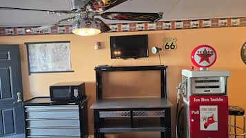
Galaxy of Hatch between Bryce and Zion
Galaxy of Hatch between Bryce and ZionHatch
8.4 dari 10, Sangat Baik, (31 ulasan)
"The decor was unique, with a motorcycle theme. The room was not fancy but clean, cleverly appointed and surprisingly quiet. It offers reasonable prices, and is an easy drive to Bryce Canyon."
Ed
Harga sekarang Rp1.275.747
total Rp1.454.639
termasuk pajak & biaya lainnya
27 Jun - 28 Jun


The Lodge at Duck Creek
The Lodge at Duck CreekMeadow View Heights
9.4 dari 10, Sempurna, (96 ulasan)
"Clean, quiet area, comfortable and cozy "
Andrea
Harga sekarang Rp3.179.679
total Rp6.325.805
termasuk pajak & biaya lainnya
6 Jul - 7 Jul


Red Canyon Village
Red Canyon VillagePanguitch
6.0 dari 10, (2 ulasan)
"We canceled .
It was a terrible location right on a busy hwy and RVs all over totally misrepresented on the web site
The manager said he canceled it on your end and I spoke with you virtual assistant who told me that the charges would be removed
Please expedite this matter
Thank you"
Peggy
Harga sekarang Rp2.673.507
total Rp3.018.923
termasuk pajak & biaya lainnya
28 Jun - 29 Jun


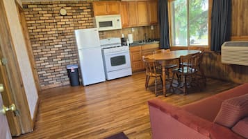
Duck Creek Village Cabin Near National Forest!
Duck Creek Village Cabin Near National Forest!Meadow View Heights


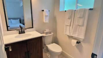
Luxe Home ~ 2 Mi to Bryce Canyon National Park!
Luxe Home ~ 2 Mi to Bryce Canyon National Park!Bryce Canyon
Harga sekarang Rp5.493.312
total Rp10.685.030
termasuk pajak & biaya lainnya
10 Jul - 11 Jul
Harga per malam terendah yang ditemukan dalam 24 jam terakhir berdasarkan pencarian 1 malam untuk 2 tamu dewasa. Harga dan ketersediaan dapat berubah sewaktu-waktu. Ketentuan tambahan mungkin berlaku.

Hemat rata-rata 15% untuk ribuan hotel saat Anda login
Penginapan dekat objek wisata populer di Alton
Selengkapnya tentang Alton
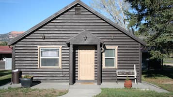
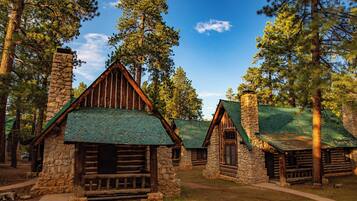
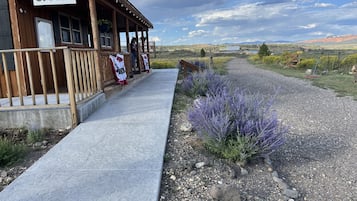
Rasakan pendakian, margasatwa, dan petualangan di Alton!

Foto oleh Eric & Kristy's Adventures
Foto Terbuka oleh Eric & Kristy's Adventures
Ulasan Hotel Teratas di Alton
Penginapan murah di Alton

Rodeway Inn Bryce Canyon
3090 UT 12 Panguitch UT
Harga Rp914.914 per malam dari 26 Jul hingga 27 Jul
Rp914.914
total Rp1.033.122
26 Jul - 27 Jul
termasuk pajak & biaya lainnya
8/10 Bagus Sekali! (1.002 ulasan)


Hotel di Alton dengan peringkat bintang

Hotel Bintang 4
2 properti

Hotel Bintang 3
66 properti

